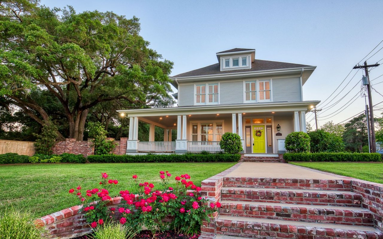
Picture your own weekend base camp within an easy drive of College Station, Houston, or Austin, where deer slip through hardwoods at sunrise and a stocked pond is just steps from your porch. If that sounds like your kind of escape, Burleson County deserves a close look. Buying recreational land here is different from buying a house in town, and a little preparation goes a long way. In this guide, you’ll learn exactly how to evaluate access, water, soils, wildlife, improvements, and the legal details that matter in Burleson County so you can buy with confidence. Let’s dive in.
Why Burleson County works for recreation
Burleson County sits in the Brazos Valley with Caldwell as the county seat. The area is mostly rural, with small towns, working acreage, and tracts near creeks, ponds, and Lake Somerville. Many buyers choose it for low‑density recreation, privacy, and a quieter feel than nearby college‑town markets.
Lake Somerville State Park and Trailway offers public boating, fishing, camping, and trails. Private ponds and local creeks support bass and catfish. Typical game includes whitetail deer, feral hogs, turkey, dove, and small game. If you want hunting, fishing, and a cabin site within a reasonable drive to services in Bryan‑College Station, Burleson County checks those boxes.
Start with your goal and budget
Before you look at tracts, get clear on use and must‑haves. Your priorities drive what to buy and where to compromise.
- Weekend retreat: Favor paved or reliable gravel access, nearby power, a buildable homesite, and low maintenance.
- Hunting first: Seek mixed cover, dependable water, space for stands and trails, and quiet from neighboring uses.
- Pond and fishing: Focus on soils that hold water, watershed size, and existing pond health or a good build site.
- Long‑term hold: Think appreciation potential, tax treatment, and future flexibility.
Title, access, and mineral rights
Your rights on paper are just as important as trees and water on the ground.
- Deeded access: Confirm recorded access from a public road or a written ingress and egress easement. Avoid informal access.
- Easements and encumbrances: Look for pipelines, utility lines, and neighbor access easements that affect building or fencing.
- Subdivision restrictions: Check recorded plats, deed restrictions, and any HOA or covenants that might limit uses or structures.
- Minerals: In Texas, mineral rights are often severed. Ask whether minerals convey and whether any oil and gas leases are active. Surface use provisions matter for recreation.
- Survey and title insurance: Order a current boundary or ALTA survey, a title commitment, and title insurance. Verify no unpaid taxes, liens, or judgments.
Roads and reliable entry
Great wildlife does not help if you cannot reach the gate.
- Road type: County‑maintained roads are often the simplest. Private roads can work, but confirm maintenance responsibilities.
- Seasonal limits: Low water crossings, slick clay, or steep entries can block access in wet months. Test drive after rain if you can.
- Road frontage: More frontage can help resale and simplify utilities, drive permits, and driveway placement.
Utilities: power, water, septic, and connectivity
Rural services vary by tract, so verify what exists and what it costs to add.
- Electricity: Identify the service provider and distance to the nearest line. Long pole runs can be costly.
- Potable water: Most parcels rely on private wells. Confirm well registration, depth, and production history if a well exists. For larger water needs, evaluate likely yield.
- On‑site sewage: Most rural properties use septic. Confirm permit history and site suitability based on soils, slopes, and depth to restrictive layers.
- Internet and cell: Coverage is spotty in places. Many owners use satellite internet or cell boosters for weekend use.
- Emergency and trash service: Ask about volunteer fire coverage, EMS response area, and solid waste options for the address.
Topography, soils, and flood risk
How the land lies affects everything from cabin siting to wildlife movement.
- Terrain: Expect flat to gently rolling ground. Walk the property to spot ideal build sites, stand locations, and trail routes.
- Soils: Soil texture and permeability influence pasture, pond seepage, and septic performance. A soil check is essential before you plan a pond or septic.
- Floodplain: Review flood mapping for creeks and low areas. Building or placing fill in flood zones can trigger permits and insurance requirements.
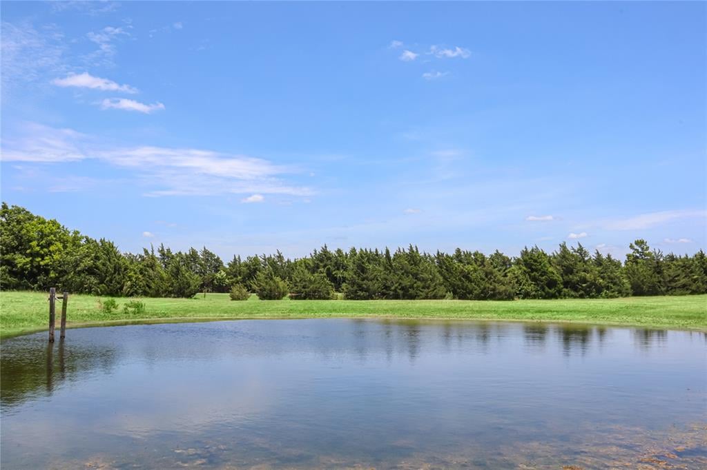
Ponds, creeks, and fishing potential
Water features are a top value driver in Burleson County.
- Pond viability: Watershed size, clay content, and construction quality determine if a pond holds water year‑round. Ask when any pond was built and by whom.
- Management: Healthy ponds often need stocking plans, aeration, or vegetation control. Confirm current fish species and forage base.
- Shoreline rules: If a tract touches Lake Somerville or a large private reservoir, check any shoreline restrictions or maintenance obligations.
Habitat and wildlife management
Hunting quality depends more on habitat than acreage alone.
- Typical cover: You will see a mix of hardwoods, brush, and grassland that supports deer, turkey, dove, and small game.
- Improvements: Food plots, selective brush control, and prescribed fire can improve habitat. Ask what has been done recently.
- Pests: Feral hogs can damage fences, trails, and fields. A control plan helps protect your investment.
Existing improvements and amenities
Evaluate both condition and legality.
- Structures: Confirm permits and basic safety for cabins, barns, and barns that include living space. Review water systems and power connections.
- Fencing: Boundary and cross‑fencing condition affects use for livestock and game management. Verify fence lines against the survey.
- Recreational setup: Trails, gates, blinds, and feeders add value and save you time on day one.
Taxes, ag valuation, and permits
Understanding local rules helps you plan and budget accurately.
- Property taxes: Contact the Burleson County Appraisal District for current assessments, rates, and any exemptions.
- Agricultural valuation: Qualified agricultural use can reduce assessed value. Confirm current status and consider roll‑back taxes if changing use.
- Permits: Septic systems, wells, larger dams or impoundments, and major culverted crossings may require permits. Check county offices and state rules before you build.
Financing, insurance, and closing steps
Raw and recreational land financing works differently than a primary home loan.
- Lenders: Farm Credit associations, regional banks, credit unions, and specialty land lenders commonly finance acreage. Some sellers may offer owner financing.
- Terms: Expect larger down payments and shorter amortization for raw land. Appraisals rely on comparable sales of similar tract types.
- Insurance: Consider property and liability coverage, especially if hosting guests or hunters. If any part lies in a mapped flood zone or near a lake or creek, review flood insurance options.
- Closing to‑do’s: Gather a signed deed, title commitment, and recorded survey. After closing, record the deed, update tax records, mark boundaries, re‑key gates, contact utilities, register wells if needed, and apply for ag valuation if eligible.
What size tract fits your plan
- Small tracts (5–20 acres): Ideal for weekenders and light hunting. Habitat quality on and around the property sets realistic expectations.
- Mid‑size tracts (20–100 acres): Better for sustainable hunting, multiple ponds, and a cabin with room for guests.
- Large tracts (100+ acres): Support long‑term wildlife and habitat goals, stronger privacy, and diversified recreation.
Price drivers and trade‑offs
Several factors tend to move values in Burleson County.
- Water: Creeks, proven wells, established ponds, or any lake frontage command premiums.
- Access: Public road frontage and reliable year‑round access increase value and ease of ownership.
- Improvements: Power, septic, quality fencing, gates, and cabins reduce your upfront spend.
- Habitat: Mature woods and mixed cover boost hunting value.
- Size and location: Larger contiguous tracts and shorter drives to Bryan‑College Station or Houston can raise demand.
- Minerals: Conveyed minerals or active leases can affect both value and surface use.
Red flags to watch
- No recorded legal access or only handshake arrangements.
- Active mineral development that could disrupt surface use.
- Unpermitted wells, septic systems, or structures.
- Significant areas in floodplain without clear build sites.
- Boundary disputes or fences that do not match the survey.
- Poor well yields, pond seepage, or soils not suited for septic.
- Heavy feral hog damage without a management plan.
Buyer checklist for Burleson County
Use this quick list as you evaluate any tract.
- Title and access
- Get a recent boundary or ALTA survey.
- Confirm recorded public access or a deeded easement.
- Review recorded easements, deed restrictions, and any HOAs.
- Ask if minerals convey and whether any oil and gas leases are active.
- Utilities and services
- Verify electric provider and distance to the nearest line.
- Confirm well presence, registration, and production history, or plan for drilling.
- Check septic permits, age, and maintenance records.
- Ask about internet options, cell coverage, EMS, fire, and trash service.
- Water and habitat
- Map all ponds, creeks, and any lake frontage. Ask when ponds were built.
- Note wildlife sign and any current hunting leases or management plans.
- Document any past flooding, erosion, or drainage fixes.
- Improvements and use
- Confirm permits for cabins, barns, and living spaces.
- Verify fence lines against the survey and note condition.
- Identify trails, blinds, feeders, and gate locations.
- Financial and tax
- Pull current taxes and ag valuation status from the appraisal district.
- Ask about any liens, special assessments, or HOA fees.
Local resources to contact
When you are serious about a tract, these resources help you verify details:
- Burleson County Appraisal District for taxes, exemptions, and assessments.
- Burleson County Clerk and County Commissioner’s Office for deeds, plats, county road maintenance, and local ordinances.
- Texas Parks and Wildlife for hunting and fishing regulations, public access, wildlife guidance, and stocking programs.
- USDA NRCS and the Web Soil Survey for soils, septic suitability, and pond potential.
- FEMA Flood Map Service for flood zones and base flood elevations.
- Texas Commission on Environmental Quality for septic, well, and dam rules.
- Texas Water Development Board for groundwater and well data.
- Texas A&M AgriLife Extension for local soil, pasture, wildlife, and pond advice.
How we help you buy with confidence
You deserve a smooth, informed purchase and a property that fits the way you live. Our team specializes in rural land and lifestyle tracts throughout the Brazos Valley. We help you line up surveys and title work, evaluate soils, wells, and septic, understand ag valuation and roll‑back risk, and weigh habitat and water features for your goals. When you are ready to explore the right tracts in Burleson County, we are here to guide each step and advocate for your best outcome.
Ready to start? Connect with the team that pairs local land expertise with the reach of a global brand. Contact Southern District Sotheby's International Realty to talk through your plan and tour available properties.
FAQs
What makes Burleson County good for recreational land?
- You get low‑density rural tracts near creeks, ponds, and Lake Somerville, with reliable access to services in Bryan‑College Station for convenience.
How do I confirm legal access to a rural tract?
- Ask for recorded public‑road frontage or a written, recorded ingress and egress easement, then verify it in the title commitment and survey.
What should I know about wells and septic in Burleson County?
- Many properties use private wells and on‑site septic; confirm permits, well registration and production history, and soil suitability before closing.
How do mineral rights affect a recreational purchase?
- In Texas, minerals may be severed; confirm if minerals convey, check for active leases, and review surface use terms that could impact recreation.
What drives price for acreage near Lake Somerville?
- Water features, year‑round access, utilities, habitat quality, tract size, and proximity to Bryan‑College Station or Houston are common price drivers.
Can I keep or add an agricultural valuation on my tract?
- If current use qualifies, you may maintain the valuation; if use changes, roll‑back taxes can apply, so confirm status and plans with the appraisal district.